|
|
|
|
|
2024 Collins Big Road Atlas Britain and Northern Ireland: A3 Spiral (Collins Road Atlas)
COLLECTIF
| $26.99
|
|
 English book English book |
 Feuilleter
|
Upon order : 2 to 4 weeks
INFORMATION
Your package will leave our warehouse within 10 to 20 days, excluding weekends and legal holidays. The delivery date will depend upon delivery by post, according to the destination distance. Deliveries within Quebec usually take from one to three days.
|
|
|
|
Add to my wish list
|
|
|
2024 Collins Big Road Atlas Britain and Northern Ireland: A3 Spiral (Collins Road Atlas)
by
COLLECTIF
| Centre les Rivières |
4225, boulevard des Forges local P13
Trois-Rivières
G8Y 1W2 |
819-376-7227 |
0 |
Opening
hours |
How to get there |
| Chicoutimi |
1120, boulevard Talbot
Chicoutimi
G7H 7R2 |
418-698-1586 |
0 |
Opening
hours |
How to get there |
| St-Romuald |
1238 rue de la Concorde
Saint-Romuald
G6W 0M7 |
418-903-1095 |
0 |
Opening
hours |
How to get there |
| Jean-Talon |
250 Jean Talon Est
Montréal
H2R 1S7 |
438-387-1091 |
0 |
Opening
hours |
How to get there |
| Lebourgneuf |
1580 boul. Lebourgneuf
Québec
G2K 2M4 |
418-380-8118 |
0 |
Opening
hours |
How to get there |
| Place des Arts |
1501 rue Jeanne-Mance
Montréal
H2X 1Z8 |
514-281-0367 |
0 |
Opening
hours |
How to get there |
| Ste-Dorothée |
520, Autoroute Chomedey
Laval
H7X 3S9 |
450-719-2020 |
0 |
Opening
hours |
How to get there |
| Ste-Foy |
2450, boul. Laurier, local M26
Québec
G1V 2L1 |
418-653-2387 |
0 |
Opening
hours |
How to get there |
| Mail Champlain |
2151, boul. La Pinière
Brossard
J4W 2T5 |
450-671-7654 |
0 |
Opening
hours |
How to get there |
| Carrefour Angrignon |
7077, Boul. Newman local 00120
Ville Lasalle
H8N 1X1 |
514-365-2587 |
0 |
Opening
hours |
How to get there |
| Avenue du Parc |
5117, avenue du Parc
Montreal
H2V 4G3 |
514-276-7651 |
0 |
Opening
hours |
How to get there |
| Beauport |
3333 rue du Carrefour local 158
Québec
G1C 5R9 |
581-742-3200 |
0 |
Opening
hours |
How to get there |
| Saint-Bruno |
205 boulevard des Promenades
St-Bruno de Montarville
J3V 5K3 |
450-653-0546 |
0 |
Opening
hours |
How to get there |
| Brossard |
6925, boul. Taschereau
Brossard
J4Z 1A7 |
450-443-5350 |
0 |
Opening
hours |
How to get there |
| Centre Laval |
1600, boul. le Corbusier #109
Laval
H7S 1Y9 |
450-682-2587 |
0 |
Opening
hours |
How to get there |
| Champigny Saint-Denis |
4380, rue St-Denis
Montréal
H2J 2L1 |
514-844-2587 |
0 |
Opening
hours |
How to get there |
| Complexe Desjardins |
C.P. 393 150, rue Ste-Cath.O - local #113
Montréal
H5B 1B5 |
514-288-4844 |
0 |
Opening
hours |
How to get there |
| Vaudreuil-Dorion |
54, Blvd De la Cité des Jeunes Local 100
Vaudreuil-Dorion
J7V 9L5 |
450-218-0571 |
0 |
Opening
hours |
How to get there |
| Plaza St-Hubert |
6255 rue Saint-Hubert
Montréal
H2S 2L9 |
514-288-0952 |
0 |
Opening
hours |
How to get there |
| Boisbriand |
3220 Av. des Grandes Tourelles, Faubourg Boisbriand
Boisbriand, QC
J7H 0A2 |
579-979-6888 |
0 |
Opening
hours |
How to get there |
| Fleury |
1691, rue Fleury Est
Montréal
H2C 1T1 |
514-384-9920 |
0 |
Opening
hours |
How to get there |
| Gatineau |
1100, Boul. Maloney Ouest
Gatineau
J8T 6G3 |
819-243-9700 |
0 |
Opening
hours |
How to get there |
| Place Longueuil |
825 rue Saint-Laurent Ouest Local : 144
Longueuill, QC
J4K 2V1 |
579-881-1402 |
0 |
Opening
hours |
How to get there |
| Granby |
50-2 rue Simonds Nord
Granby
J2J 2L1 |
450-375-0699 |
0 |
Opening
hours |
How to get there |
| Saint-Jérome |
900, boul. Grignon local # 60
St-Jérôme
J7Y 3S7 |
450-432-9100 |
0 |
Opening
hours |
How to get there |
| Pointe-Claire |
6815, Route Transcanadienne, Local C001
Pointe-Claire
H9R 1C4 |
514-782-1222 |
0 |
Opening
hours |
How to get there |
| Rosemère |
382 boul. Labelle
Rosemère
J7A 3R8 |
450-434-0202 |
0 |
Opening
hours |
How to get there |
| Carrefour Laval |
3035 Boulevard Le Carrefour Local SR24B
Laval
H7T 1C8 |
450-681-3032 |
0 |
Opening
hours |
How to get there |
| Drummondville |
520 boul Saint-Joseph
Drummondville
J2C 2B8 |
819-850-2000 |
0 |
Opening
hours |
How to get there |
| St-Georges de Beauce |
8540, Boulevard Lacroix
St-Georges de Beauce
G5Y 2B5 |
418-227-3182 |
0 |
Opening
hours |
How to get there |
| Côte-des-Neiges |
5252, chemin Côte-des-Neiges
Montréal
H3T 1X8 |
514-342-1515 |
0 |
Opening
hours |
How to get there |
| Repentigny |
100 Boul. Brien Ouest, local 158b
Repentigny
J6A 5N4 |
450-932-6892 |
0 |
Heures
d'ouverture |
How to get there |
| Trois-Rivières |
3275, Boul des Récollets
Trois-Rivières
G9A 6M1 |
819-840-2624 |
0 |
Opening
hours |
How to get there |
| Centre Rockland |
2305 Chemin Rockland
Mont-Royal
H3P 3E9 |
514-543-5221 |
0 |
Mo Tue Wed
9.00 AM to 9.00 PM
Thu Fr
9.00 AM to 9 PM
Sat
9 AM to 6 PM
Sun
10 AM to 6 PM |
How to get there |
| Place du Royaume |
1401 boulevard Talbot local #170
Chicoutimi
G7H 5N6 |
581-654-1127 |
0 |
Opening
hours |
How to get there |
| Carrefour l'Estrie |
3050, boul. Portland - local N-11
Sherbrooke
J1L 1K1 |
819-569-9957 |
0 |
Opening
hours |
How to get there |
| St-Jean-sur-Richelieu |
927 Boulevard Séminaire Nord
Montréal
J3A 1B5 |
579-381-1110 |
0 |
Not
avalaible |
|
| Sorel |
450, boul. Poliquin - Local 102
Sorel
J3P 7R5 |
450-746-8771 |
0 |
Opening
hours |
How to get there |
| Les Galeries de Terrebonne |
1185, boul. Moody Local 081
Terrebonne
J6W 3Z5 |
450-492-1011 |
0 |
Opening
hours |
How to get there |
| Lévis |
1200 Alphonse-Desjardins #0120
Lévis
G6V 6Y8 |
418-837-5538 |
0 |
Opening
hours |
How to get there |
| Galeries d Anjou |
7999, boul. Les Galeries d'Anjou
Ville d'Anjou
H1M 1W6 |
514-353-2353 |
0 |
Opening
hours |
How to get there |
| Victoriaville |
1111, boul. Jutras Est - Local 1
Victoriaville
G6S 1C1 |
819-357-4878 |
0 |
Opening
hours |
How to get there |
| Place Ville Marie |
1 Place Ville-Marie, local 11170
Montréal, QC
H3B 2C4 |
514-552-9649 |
0 |
Opening
hours |
How to get there |
|
|
|
|
LEARN MORE
Summary
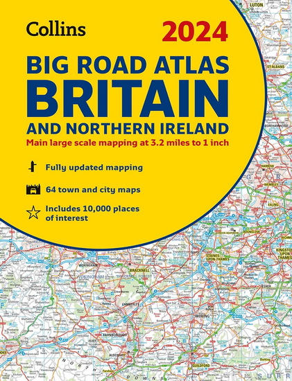
The ultimate 3.2 miles to 1 inch scale large format paperback road atlas of Britain, featuring Collins’ popular and well established road mapping, and designed for exceptional clarity and ease of use.
The atlas has a wide range of urban area maps at even larger scale and 64 detailed town centre street plans.
This fully updated road atlas covers the whole of Britain with each scale of mapping colour-coded for ease of use. The smallest scale maps are great for long distance route planning and the street plans help you locate your final destination.
Main features:
Easy to use, clear road maps at a scale of 3.2 miles to 1 inch of England, Wales and Southern Scotland. Northern Scotland is shown at 5 miles to 1 inch
Route planning section including maps at a scale of 15.8 miles to 1 inch for long distance route planning, motorway services information and a handy distance calculator
22 urban area approach maps at 1 mile to 1 inch which clearly show the best routes through and into the busiest built-up areas
64 street maps focused on town centres showing places of interest, car park locations and one-way streets
M25 orbital map
Information about restricted motorway junctions
Park & Ride locations shown, ideal when visiting towns and cities
Over 30 categories of places of interest including castles, theme parks, sports venues, universities, mountain bike trails and surfing beaches
Full postcodes for the top 1000 places of interest – ideal for use alongside satnav systems
Details
|
Price:
|
$26.99
|
|
Category:
|
|
|
Author:
|
COLLECTIF
|
|
Title:
|
2024 Collins Big Road Atlas Britain and Northern Ireland: A3 Spiral (Collins Road Atlas)
|
|
Release date:
|
11 August 2023
|
|
|
|
|
|
Editor:
|
HARPER COLLINS
|
|
|
|
|
|
Subject:
|
ATLAS
|
|
ISBN:
|
9780008597603 (000859760X)
|
|
Renaud-Bray Reference:
|
19090825
|
|
|
|
Item nb:
|
4019659
|
2024 Collins Big Road Atlas Britain and Northern Ireland: A3 Spiral (Collins Road Atlas)
,
COLLECTIF
©
HARPER COLLINS
2023
|
|
1449 item(s) in your cart.
Renaud-Bray will pay
the shipping costs *
|