|
|
|
|
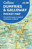
7,99 $
Handy little full colour map of Dumfries & Galloway.
Main features of this map include:
• Clear mapping
• Main tourist attractions located and described
• Ideal for touring with sights, place... » Lire la suite...
COLLINS
|
janvier 2023
|
Sur commande :
2 à 4 semaines
|
|
|
|
|
|
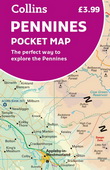
7,99 $
Handy little full colour map of the Pennines.
Main features of this map include:
• Clear mapping
• Main tourist attractions located and described
• Ideal for touring with sights, places to st... » Lire la suite...
COLLINS
|
janvier 2023
|
Sur commande :
2 à 4 semaines
|
|
|
|
|

|
12,99 $
A pocket-sized, paperback street atlas of Central London and the surrounding areas in full colour.
Covering an area extending from the centre of London to: Brent Cross, Golders Green, Highgate, ... » Lire la suite...
HARPER COLLINS
|
mars 2023
|
Sur commande :
2 à 4 semaines
|
|
|
|
|

|
14,99 $
Navigate your way around London with this detailed, easy-to-use, and up-to-date A-Z Premier Map.
A full-colour, single sided, fold-out street map, covering a six-mile radius from Charing Cross i... » Lire la suite...
HARPER COLLINS
|
mars 2023
|
Sur commande :
2 à 4 semaines
|
|
|
|
|
|
10,99 $
A single-sided, fold-out road map featuring motorways, primary routes, 'A' Roads and a selection of other routes in full-colour. Mapping you can trust from A-Z.
Highlights include:
Clear ... » Lire la suite...
HARPER COLLINS
|
mars 2023
|
Sur commande :
2 à 4 semaines
|
|
|
|
|
|
5,99 $
This great value, fold-out map uses our instantly recognisable A-Z street mapping and has handy a TfL Tube map on the back for easy access.
Published at a scale of 3.5 inches to 1 mile, the map ... » Lire la suite...
HARPER COLLINS
|
mars 2023
|
Sur commande :
2 à 4 semaines
|
|
|
|
|

|
7,99 $
Clear and easy-to-read map of central London and surrounding area. Contains detailed mapping, presented in a handy compact format. This attractive map, ideal for both tourists and residents, and fu... » Lire la suite...
HARPER COLLINS
|
mars 2023
|
Sur commande :
2 à 4 semaines
|
|
|
|
|
|
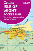
7,99 $
Explore new places with handy pocket maps from Collins.
Handy little full-colour map of the Isle of Wight. Detailed mapping and tourist information of the whole island.
With its stunning sea ... » Lire la suite...
COLLINS
|
avril 2023
|
Sur commande :
2 à 4 semaines
|
|
|
|
|
|
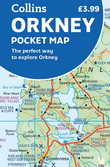
7,99 $
Explore new places with handy pocket maps from Collins.
Handy little full colour map of the Orkney Islands in Scotland. Detailed mapping and tourist information for Orkney mainland, Westray, San... » Lire la suite...
COLLINS
|
avril 2023
|
Sur commande :
2 à 4 semaines
|
|
|
|
|
|
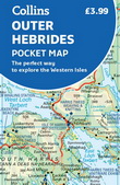
7,99 $
Explore new places with handy pocket maps from Collins.
Handy little full-colour map of the Western Isles of Scotland. Detailed mapping and tourist information for the islands of Lewis, Harris, ... » Lire la suite...
COLLINS
|
avril 2023
|
Sur commande :
2 à 4 semaines
|
|
|
|
|
|
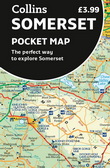
7,99 $
Explore new places with handy pocket maps from Collins.
Handy little full-colour map of county of Somerset. Detailed mapping, photographs and tourist information.
Famed for its cheddar cheese... » Lire la suite...
COLLINS
|
avril 2023
|
Sur commande :
2 à 4 semaines
|
|
|
|
|
|
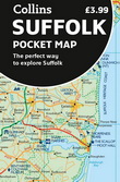
7,99 $
Explore new places with handy pocket maps from Collins.
Handy little full-colour map of county of Suffolk. Detailed mapping, photographs, and tourist information.
Famed for its archaeological... » Lire la suite...
COLLINS
|
avril 2023
|
Sur commande :
2 à 4 semaines
|
|
|
|
|
|
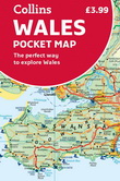
7,99 $
Explore new places with handy pocket maps from Collins.
Handy little full-colour map of Wales. Excellent value and very detailed for its size.
This map is ideal for touring and main features ... » Lire la suite...
COLLINS
|
avril 2023
|
Sur commande :
2 à 4 semaines
|
|
|
|
|
|
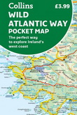
7,99 $
Explore new places with handy pocket maps from Collins.
Handy full-colour map of Ireland’s Wild Atlantic Way with a high level of detail. Clear mapping of the full 2500 km (over 1500 miles) rout... » Lire la suite...
COLLINS
|
avril 2023
|
Sur commande :
2 à 4 semaines
|
|
|
|
|
|
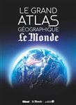
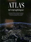
100,00 $
Atlas mondial physique et politique des différentes régions géographiques du monde, y compris les océans. Avec une série de photographies prises de l'espace, un répertoire synthétique des principal... » Lire la suite...
GLENAT
|
janvier 2023
|
|
49,95 $
Cartographie du monde avec des données physiques, politiques et sociales sur toutes les grandes régions. Chaque continent est présenté, avec un texte descriptif et informatif suivi d'une vaste cart... » Lire la suite...
PLACE DES VICTOIRES
|
décembre 2023
|
|
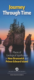
8,95 $
A full-colour folding map exploring the geological highlights of New Brunswick and PEI.
This detailed, full-colour, double-sided folding map features 90 geological highlights of New Brunswick an... » Lire la suite...
NIMBUS PUBLISHING
|
mai 2022
|
Sur commande :
Habituellement expédié en 4 à 10 jours.
|
|
|
|
|
|
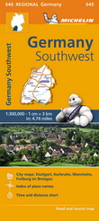
15,99 $
MICHELIN
|
août 2022
|
|
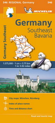
15,99 $
With MICHELIN Regional Maps, find more than just your way! In addition to Michelin's clear and accurate mapping, the regional map series includes all the practical information for a trouble free jo... » Lire la suite...
MICHELIN
|
septembre 2022
|
|
16,99 $
MICHELIN
|
août 2022
|
|
41,95 $
Panorama des curiosités frontalières à travers le monde : villes enclavées dans un pays appartenant à un pays voisin, délimitations disparues mais ayant indélébilement marqué le territoire, régions... » Lire la suite...
ARMAND COLIN
|
janvier 2023
|
Sur commande :
Habituellement expédié en 4 à 10 jours.
|
|
|
|
|
|
47,95 $
Atlas des curiosités géographiques . Un pays qui n'existe pas, une île qui est espagnole la moitié de l'année et française l'autre moitié, une chambre d'hôtel dont le lit est en F... » Lire la suite...
ED. JONGLEZ
|
janvier 2023
|
Sur commande :
2 à 4 semaines
|
|
|
|
|
|
37,99 $
With more than 250 maps, graphics, and illustrations, the National Geographic Concise Atlas of the World offers an authoritative and engaging portrayal of the world and all that is in it.
Expert... » Lire la suite...
NATIONAL GEOGRAPHIC
|
septembre 2022
|
Sur commande :
2 à 4 semaines
|
|
|
|
|

|
52,00 $
Reeds Astro Navigation Tables is the established book of annual astro-navigation tables compiled specifically for the needs of boaters.
It contains all the information the ocean-going sailor nee... » Lire la suite...
BLOOMSBURY
|
octobre 2022
|
Sur commande :
2 à 4 semaines
|
|
|
|
|

|
60,95 $
Atlas mondial physique et politique des différentes régions géographiques du monde, y compris les océans. Avec une série de photographies prises depuis l'espace.
GLENAT
|
novembre 2022
|
|
16,95 $
Highlighting 51 road trips and scenic drives the Michelin's updated Large Format North America Road Atlas 2023 helps you enjoy the planning and the journey. Large-format maps and larger lettering f... » Lire la suite...
MICHELIN
|
mai 2022
|
|
25,99 $
For inspiring road trips and scenic drives, Michelin's updated, spiral-bound North America Road Atlas 2023 suggests 52 routes. The tiled atlas, with its clear, accurate mapping, complements online ... » Lire la suite...
MICHELIN
|
mai 2022
|
|
12,99 $
Discover new places with handy maps from Collins.
A fully revised and updated colour road map of France at 18 miles to 1 inch / 11km to 1cm. The map shows individual departments by name. All cit... » Lire la suite...
COLLINS
|
mars 2022
|
Sur commande :
2 à 4 semaines
|
|
|
|
|
|
29,95 $
Des cartes thématiques et des fiches, classées par continent et par ordre alphabétique, proposant pour chaque pays des données de géographie physique, de démographie, d'économie et d'histoire.
LAROUSSE
|
septembre 2022
|
|
24,99 $
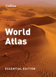
A new fully updated reference atlas in the exciting Collins world atlas range. Great value and contains all the world maps you need in a budget atlas, for family, study and business use.
Explore... » Lire la suite...
COLLINS
|
août 2022
|
Sur commande :
2 à 4 semaines
|
|
|
|
|
|
20,99 $
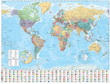
Explore the world with a Collins wall map
Fully updated world map to include the latest political changes. Contains politically coloured mapping showing each country and their capital city, majo... » Lire la suite...
COLLINS
|
mai 2022
|
Sur commande :
2 à 4 semaines
|
|
|
|
|

|
18,99 $
Explore the world with a Collins wall map
Fully updated world map to include the latest political changes. The map contains politically coloured mapping which shows each country and their capita... » Lire la suite...
COLLINS
|
mai 2022
|
Sur commande :
2 à 4 semaines
|
|
|
|
|
|
11,99 $
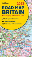
Discover new places with fully updated road atlases from Collins.
Full colour double-sided map of Great Britain at 8.7 miles to 1 inch (1:550,000), with clear, detailed road network and administ... » Lire la suite...
COLLINS
|
juin 2022
|
Sur commande :
2 à 4 semaines
|
|
|
|
|
|
11,99 $
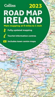
Discover new places with fully updated road atlases from Collins.
Full colour map of Ireland at 9 miles to 1 inch (1:570,240), with clear, detailed road network and counties and new administrati... » Lire la suite...
COLLINS
|
juin 2022
|
Sur commande :
2 à 4 semaines
|
|
|
|
|
|
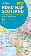
11,99 $
Discover new places with fully updated road atlases from Collins.
Full colour map of Scotland at 8.7 miles to 1 inch with clear, detailed road network and administrative areas shown in colour. T... » Lire la suite...
COLLINS
|
juin 2022
|
Sur commande :
2 à 4 semaines
|
|
|
|
|
|
21,00 $
Discover new places with fully updated road atlases from Collins.
The ultimate 3.2 miles to 1 inch scale large format paperback road atlas of Britain, featuring Collins’ popular and well establi... » Lire la suite...
COLLINS
|
juin 2022
|
Sur commande :
2 à 4 semaines
|
|
|
|
|
|
12,99 $
Discover new places with fully updated road atlases from Collins.
This easy-to-use, handy A5 sized road atlas with popular lie-flat spiral binding features extremely clear route planning maps of... » Lire la suite...
COLLINS
|
juin 2022
|
Sur commande :
2 à 4 semaines
|
|
|
|
|
|
12,99 $
Discover new places with handy road atlases from Collins.
Explore Ireland with this handy format route-planning atlas in full colour, complete with information on places of tourist interest incl... » Lire la suite...
COLLINS
|
mars 2022
|
Sur commande :
2 à 4 semaines
|
|
|
|
|

|
22,99 $
Navigate your way around Birmingham with this detailed and easy-to-use A-Z Street Atlas.
Printed in full-colour, paperback format, this atlas contains 164 pages of continuous street mapping.
... » Lire la suite...
COLLINS
|
avril 2022
|
Sur commande :
2 à 4 semaines
|
|
|
|
|
|
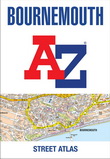
17,99 $
Navigate your way around Bournemouth with this detailed and easy-to-use A-Z Street Atlas.
Printed in full-colour, paperback format, this atlas contains 63 pages of continuous street mapping.
... » Lire la suite...
COLLINS
|
avril 2022
|
Sur commande :
2 à 4 semaines
|
|
|
|
|
|
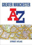
22,99 $
Navigate your way around Manchester with this detailed and easy-to-use A-Z Street Atlas.
Printed in full-colour, paperback format, this atlas contains 122 pages of continuous street mapping.
... » Lire la suite...
COLLINS
|
avril 2022
|
Sur commande :
2 à 4 semaines
|
|
|
|
|
|
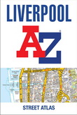
22,99 $
Navigate your way around Liverpool with this detailed and easy-to-use A-Z Street Atlas.
Printed in full-colour, paperback format, this atlas contains 120 pages of continuous street mapping.
C... » Lire la suite...
COLLINS
|
avril 2022
|
Sur commande :
2 à 4 semaines
|
|
|
|
|
|
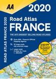
37,95 $
Fully revised and updated for 2020, this specialist A4 road atlas includes 32 city centre plans to help you find your way in and around busy centers. Road mapping for Corsica is included, plus 10 d... » Lire la suite...
AA PUBLISHING
|
septembre 2019
|
Sur commande :
2 à 4 semaines
|
|
|
|
|
|
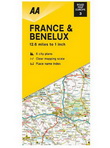
15,95 $
New editions, fully updated. Clear, detailed Europe mapping from the experts at the AA, in a handy foldable map. The maps combine clear design and an easy-to-read scale with more road detail to ens... » Lire la suite...
AA PUBLISHING
|
mars 2020
|
Sur commande :
2 à 4 semaines
|
|
|
|
|
|
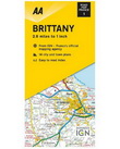
15,95 $
New editions, fully updated. France’s clearest mapping from the experts at the AA, in a handy foldable map. The maps combine clear design and an easy-to-read scale with more road detail to ensure t... » Lire la suite...
AA PUBLISHING
|
mars 2020
|
Sur commande :
2 à 4 semaines
|
|
|
|
|
|
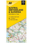
15,95 $
New editions, fully updated. Clear, detailed Europe mapping from the experts at the AA, in a handy foldable map. The maps combine clear design and an easy-to-read scale with more road detail to ens... » Lire la suite...
AA PUBLISHING
|
mars 2020
|
Sur commande :
2 à 4 semaines
|
|
|
|
|
|
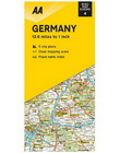
15,95 $
New editions, fully updated. Clear, detailed Europe mapping from the experts at the AA, in a handy foldable map. The maps combine clear design and an easy-to-read scale with more road detail to ens... » Lire la suite...
AA PUBLISHING
|
mars 2020
|
Sur commande :
2 à 4 semaines
|
|
|
|
|
|
15,95 $
New editions, fully updated. Clear, detailed Europe mapping from the experts at the AA, in a handy foldable map. The maps combine clear design and an easy-to-read scale with more road detail to ens... » Lire la suite...
AA PUBLISHING
|
mars 2020
|
Sur commande :
2 à 4 semaines
|
|
|
|
|
|
15,95 $
New editions, fully updated. France’s clearest mapping from the experts at the AA, in a handy foldable map. The maps combine clear design and an easy-to-read scale with more road detail to ensure t... » Lire la suite...
AA PUBLISHING
|
mars 2020
|
Sur commande :
2 à 4 semaines
|
|
|
|
|

|
21,95 $
Le Routard . Le Carnet de Voyage du Routard à personnaliser, le précieux compagnon de tous les voyages ! . - Des cartes, des to-do, des check-list pour org...
» Lire la suite...
HACHETTE TOURISME
|
janvier 2022
|
|
|
1449 article(s) au panier.
Renaud-Bray vous offre
les frais de livraison *
|