|
|
|
|
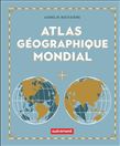
62,95 $
Pour comprendre le monde et ses enjeux, cet atlas propose des cartes sur de grandes thématiques (monde politique, milieux naturels, volcanisme, etc.) et des cartes politiques et physiques de chaque... » Lire la suite...
AUTREMENT
|
août 2024
|
En stock :
Habituellement expédié en 3 à 5 jours.
|
|
|
|
|

|
16,95 $
Highlighting 51 road trips and scenic drives the Michelin's updated Large Format North America Road Atlas 2025 helps you enjoy the planning and the journey. Large-format maps and larger lettering f... » Lire la suite...
MICHELIN
|
mai 2024
|

|
25,99 $
For inspiring road trips and scenic drives, Michelin's updated, spiral-bound North America Road Atlas 2025 suggests 52 routes. The tiled atlas, with its clear, accurate mapping, complements online ... » Lire la suite...
MICHELIN
|
mai 2024
|

|
29,95 $
Atlas socio-économique des pays du monde 2025 . Complet, pratique et utile . Pour chaque pays : - un descriptif du milieu naturel ;
- la fiche...
» Lire la suite...
LAROUSSE
|
août 2024
|

|
12,99 $
Explore the whole county and area extending into Devon as far as Great Torrington, Tavistock and Plymouth. This detailed and up-to-date map contains more than 1,000 places of interest and an index ... » Lire la suite...
HARPER COLLINS
|
février 2024
|
Sur commande :
2 à 4 semaines
|
|
|
|
|
|
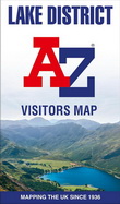
12,99 $
Explore the whole region and area extending from Cockermouth and Penrith in the north to Ulverston and Grange-over-Sands in the south and from the M6 in the east to the coast in the west.
Publis... » Lire la suite...
HARPER COLLINS
|
février 2024
|
Sur commande :
2 à 4 semaines
|
|
|
|
|
|
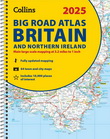
26,99 $
Explore Britain with easy-to-read mapping from Collins.
The ultimate 3.2 miles to 1 inch scale large-format, spiral-bound road atlas of Britain, featuring Collins’ popular and well established r... » Lire la suite...
COLLINS
|
mars 2024
|
Sur commande :
2 à 4 semaines
|
|
|
|
|
|
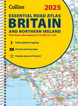
26,99 $
Explore Britain with easy-to-read mapping from Collins.
This A4, spiral-bound road atlas provides clear and detailed road mapping for England, Wales and Southern Scotland at a scale of 3.2 miles... » Lire la suite...
COLLINS
|
mars 2024
|
Sur commande :
2 à 4 semaines
|
|
|
|
|
|
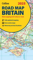
11,99 $
Explore Britain with easy-to-read mapping from Collins.
Full-colour, double-sided road map of Great Britain at a scale of 8.7 miles to 1 inch. Northern England, Scotland and the Isle of Man are ... » Lire la suite...
COLLINS
|
mars 2024
|
Sur commande :
2 à 4 semaines
|
|
|
|
|
|
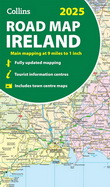
11,99 $
Explore Ireland with easy-to-read mapping from Collins.
Full-colour map of Ireland at 9 miles to 1 inch (1:570,240), with clear, detailed road network and counties and new administrative areas s... » Lire la suite...
COLLINS
|
mars 2024
|
Sur commande :
2 à 4 semaines
|
|
|
|
|
|
|
1449 article(s) au panier.
Renaud-Bray vous offre
les frais de livraison *
|