|
|
|

|
7,99 $
Discover new places with handy pocket maps from Collins.
Fully updated and very detailed for its size, this is a full-colour, double-sided map of Scotland. Showing the Central Belt, southern Sco... » Lire la suite...
COLLINS
|
mars 2026
|
Sur commande :
2 à 4 semaines
|
|
|
|
|

|
26,99 $
Explore Britain with easy-to-read mapping from Collins.
The ultimate 3.2 miles to 1 inch scale large-format, spiral-bound road atlas of Britain, featuring Collins’ popular and well-established r... » Lire la suite...
COLLINS
|
mars 2026
|
Sur commande :
2 à 4 semaines
|
|
|
|
|
|
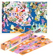
34,99 $
The Unofficial Taylor Swift Eras Tour Map is the must-have souvenir for any Swiftie.
11 albums. 149 concerts. Five continents. From the emotional rollercoaster of scoring tickets to costume prep... » Lire la suite...
HARDIE GRANT BOOKS
|
mars 2026
|
Sur commande :
2 à 4 semaines
|
|
|
|
|

|
22,99 $
Lively, loud and exceptionally colourful, New Orleans is home to swinging jazz clubs, iconic streetcars, beautiful balconied houses, and a dynamic culture which reflects the city's unique history a... » Lire la suite...
DORLING KINDERSLEY
|
janvier 2026
|
Sur commande :
2 à 4 semaines
|
|
|
|
|

|
12,99 $
Explore new places with this comprehensive map of Ireland from Collins.
An easy-to-use route-planning map covering the whole of Ireland. It has the convenience of an atlas with all the benefits ... » Lire la suite...
COLLINS
|
février 2026
|
Sur commande :
2 à 4 semaines
|
|
|
|
|
|
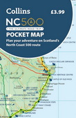
7,99 $
Explore new places with handy pocket maps from Collins.
Handy little full colour map of the popular North Coast 500 route. A perfect guide for travelling around Northern Scotland. Detailed mappi... » Lire la suite...
COLLINS
|
février 2026
|
Sur commande :
2 à 4 semaines
|
|
|
|
|

|
12,99 $
Explore Ireland with this accurate and fully updated road atlas.
This handy A4-sized atlas covers the whole of Ireland with clear, detailed Collins color mapping at a scale of 5.2 miles to 1 inc... » Lire la suite...
COLLINS
|
février 2026
|
Sur commande :
2 à 4 semaines
|
|
|
|
|

|
7,99 $
Explore new places with handy pocket maps from Collins.
Handy full-color map of Ireland’s Wild Atlantic Way with a high level of detail. Clear mapping of the full 2500 km (over 1500 miles) route... » Lire la suite...
COLLINS
|
février 2026
|
Sur commande :
2 à 4 semaines
|
|
|
|
|

|
19,99 $
The A-Z Adventure Series of maps combines the best of OS and A-Z, creating the perfect companion for walkers, off-road cyclists, horse riders and anyone wishing to explore the great outdoors.
Th... » Lire la suite...
HARPER COLLINS
|
février 2026
|
Sur commande :
2 à 4 semaines
|
|
|
|
|

|
19,99 $
The A-Z Adventure series features the accuracy and quality of Ordnance Survey's 1:25000 mapping in a convenient book, therefore eliminating the need to fold and re-fold a large sheet map to the des... » Lire la suite...
HARPER COLLINS
|
février 2026
|
Sur commande :
2 à 4 semaines
|
|
|
|
|
|
|
1449 article(s) au panier.
Renaud-Bray vous offre
les frais de livraison *
|